Drones changed the way surveyors work. A UAV survey lets crews map land, check elevations, and stake out subdivisions faster than ever. In Monroe County, most surveyors use DJI drones for sitework. These drones are trusted, affordable, and easy to use with mapping software.
But now, big changes may be coming. U.S. lawmakers are moving to block new DJI sales. If that freeze starts in December, surveyors in Rochester and nearby towns may not be able to buy new drones or order replacement parts. That could cause delays on projects and create stress for builders, lenders, and homeowners.
Why DJI Restrictions Matter
Survey work in Monroe County is often tied to tight schedules. Contractors need quick site checks. Developers want subdivision layouts ready before permits expire. Town offices rely on accurate flood maps.
DJI drones make those jobs possible because they can fly long missions and produce clear, accurate data. Without them, surveyors may face major challenges. Losing access to drones or parts could mean longer project timelines and higher costs.
What Happens If UAV Survey Fleets Shrink
Picture a subdivision project. A surveyor is using a drone to measure grading and stake out utilities. If the drone breaks and no replacement is available, work slows down. Crews may have to collect data by hand. That takes more time and raises costs.
The ripple effect is clear: engineers wait longer for topo maps, lenders can’t close loans on time, and property owners see construction delayed.
Other UAV Survey Options
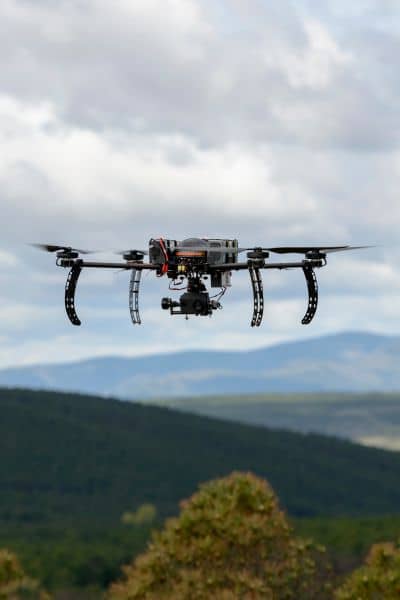
DJI is the market leader, but other companies also build survey drones. Some U.S. and European brands make UAVs that meet new government rules. The downside is that these drones are more expensive and usually cannot fly as long.
For example, a job that one DJI drone can finish in 30 minutes may take two or three flights with another model. That means longer days in the field and higher prices for clients. Surveyors will need to explain these trade-offs clearly.
Keeping Data Consistent
Another problem is data continuity. Many projects begin with DJI drone data. If a different UAV is used halfway through, files may not line up. Images, control points, and coordinates can vary from system to system.
Take a small infill lot in Rochester’s 19th Ward. If half the topo map comes from DJI and the rest from another drone, the data may not match. That could force the surveyor to redo work, which wastes time and money.
Why Timing Matters
The freeze could hit right at the end of the year. That is when many surveyors prepare for winter staking and early spring planning. Firms that wait too long may not have the equipment needed when projects start.
Buying new drones now, or at least stocking up on batteries and parts, can prevent headaches later. Being proactive will keep survey crews moving while others scramble.
What Surveyors Should Watch
Government agencies are still reviewing DJI’s place on the Covered List. Policy updates can change quickly. Local survey firms should follow weekly news to know what is coming. Industry groups and trade journals will also provide updates.
For surveyors, the next few months are about balance. Over-spending on backup systems may not make sense, but doing nothing could be worse. Planning ahead is the smart move.
Looking Ahead
Drone technology is not going away. UAV survey methods save time, improve accuracy, and lower costs. Even if DJI faces limits, the demand for fast aerial mapping will stay strong. New manufacturers will step in. Software will adjust.
The main challenge is in the transition. Surveyors who log their fleet, line up options, and prepare clients will keep projects on schedule. Those who ignore the news risk having grounded drones and unhappy customers.
Final Thoughts
The possible DJI freeze is a reminder that local sitework depends on global policy. For builders and homeowners, one question matters most: is your surveyor ready?
If they have a plan for UAV survey work beyond DJI, your project is safer. If not, delays may be ahead. By preparing now, the survey community can handle change and keep projects moving without missing a beat.
