If you’re a developer, you might have heard about subdivision surveys. But what exactly are they, and why are they so important before you start building? This blog will explain subdivision surveys in simple, clear terms. You’ll learn why these surveys are key to making sure your project goes smoothly and avoids costly problems.
Subdivision surveys help divide a large piece of land into smaller parts, like lots for houses or businesses. Developers use these surveys to confirm that each new piece of land has clear boundaries and follows local rules. Without a proper subdivision survey, you could face problems with property lines, legal troubles, or delays that slow down your project.
What Is a Subdivision Survey?
A subdivision survey is a detailed map and report showing how a big piece of land will be divided into smaller lots. Imagine you own a large plot and want to create a new neighborhood or commercial area. Before you build, you need to know exactly where each lot begins and ends. That’s where subdivision surveys come in.
These surveys show property lines, roads, utility easements (which are parts of land others can use, like for power lines), and natural features such as streams or hills. Subdivision surveys are more detailed than regular property surveys because they include all the things developers need to plan a project properly.
In short, a subdivision survey turns a big piece of land into a clear plan with legal boundaries. This helps avoid confusion later on about where one lot ends and another begins.
Why Are Subdivision Surveys Important for Developers?
Rochester has rules about land use that developers must follow. These rules include zoning laws that control how land can be divided and built upon. A subdivision survey helps make sure your project fits within these rules.
Subdivision surveys are part of what’s called “due diligence.” This means checking all the facts about a property before you buy or develop it. With a subdivision survey, you can find hidden problems early—like unclear boundaries or land that might not be usable. This saves you time, money, and headaches later on.
Also, local agencies, like the Planning Board, usually require subdivision surveys before they approve your project. Without this survey, you may not get the permits needed to build.
How Does a Subdivision Survey Work?

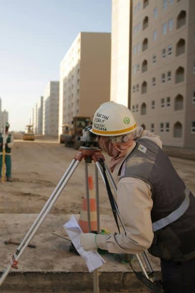
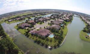
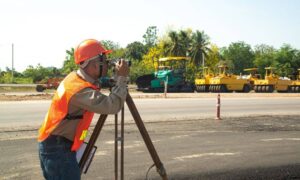
When you hire a licensed land surveyor they begin by visiting your property. They measure the land carefully using high-tech tools like GPS equipment and sometimes drones. These tools help them get very accurate measurements.
The surveyor then draws a detailed map showing the entire property and how it will be split into smaller lots. This map also shows important details like where roads will go, utility easements, and any special land features.
Next, the surveyor submits the plan to local officials to check if it meets all city and county requirements. This review includes zoning laws, environmental rules, and access to public roads.
Once approved, the subdivision plan is recorded. This means it becomes an official document that anyone can check to see the legal boundaries of the new lots.
Usually, this whole process takes a few weeks but can vary depending on the size of your land and how complex the subdivision is.
Common Problems Developers Face With Subdivision Surveys
Subdivision surveys often reveal surprises. For example, the survey might show that part of your land overlaps with a neighbor’s property. If that happens, you may need to negotiate a boundary agreement or change your plans.
Sometimes, subdivision surveys find hidden easements. These are rights other people have to use parts of your land for things like power lines or sewer pipes. These easements can limit how you build on the property.
Also, natural features like wetlands or flood zones might appear on the survey. Rochester has strict rules about building in these areas, so your plans may need to change.
Weather can also cause delays. Rochester winters with snow and ice make it hard for surveyors to do their work outdoors.
How Subdivision Surveys Help Avoid Legal Issues
One of the biggest benefits of subdivision surveys is preventing legal disputes. If you know exactly where your property lines are, you won’t risk building on someone else’s land. This clarity protects you and future property owners.
Subdivision surveys also make sure your project follows local laws. If you skip this step and your subdivision doesn’t meet zoning rules, you could face fines or be forced to undo construction.
Mortgage lenders and title companies often require subdivision surveys before approving loans. This means having a proper survey is essential if you want to secure financing for your project.
How Subdivision Surveys Connect With Other Types of Surveys
Subdivision surveys are part of a bigger family of land surveys. For example, you may also need a boundary survey to confirm exact property lines. Or an ALTA/NSPS land title survey, which is more detailed and used mainly for commercial property deals and loan closings.
In Rochester, many surveyors now use drone surveying or aerial surveying to collect data faster and more accurately. These tools complement traditional surveys and can speed up the process.
After your subdivision survey, you may need a construction staking survey. This type of survey helps builders know exactly where to place roads, buildings, and utilities based on the subdivision plan.
What Should Developers Ask Their Surveyors?
When you hire a surveyor, it’s important to ask the right questions to get the best results:
- Will the survey meet local government and zoning requirements?
- Does the survey follow ALTA/NSPS standards if necessary?
- What exactly will the survey report include? Will I get a clear map and legal descriptions?
- How long will the survey take, and what will it cost?
- Can you help with permits or dealing with local officials?
- Do you use modern tools like drones or GPS for better accuracy?
A good surveyor will be happy to explain the process and keep you informed every step of the way.
How Subdivision Surveys Help Make Development Easier
Subdivision surveys aren’t just about lines on a map—they make the whole development process easier. They give you a clear plan to follow, so your construction crew knows where to build roads and houses.
If your project is in a flood-prone area, subdivision surveys work with elevation certificates and FEMA flood maps to ensure your buildings are safe and meet regulations.
Surveys also help with perc tests (percolation tests), which check if the soil can handle septic systems. This is important for residential developments where sewer lines may not be available.
Conclusion:
Starting a development project without a subdivision survey is risky. It’s like trying to build a house without a blueprint. You need a clear plan, legal approval, and peace of mind that your property lines are correct.
Subdivision surveys help you avoid legal problems, save money, and make sure your project meets local rules. They protect your investment and keep everything moving smoothly from start to finish.
When you’re ready to break ground, look for a licensed land surveyor who offers solid land survey solutions tailored to your project. With the right expertise and modern tools, these solutions make the whole process easier and give you the confidence to build on a strong foundation.


