Rochester just had its first big freeze warning, and most people are busy covering plants or scraping ice off windshields. But there’s something most homeowners overlook—how sudden temperature drops can quietly affect their property. If you’ve had new driveway work, road improvements near your home, or drainage changes this year, this cold snap could shift more than just your morning routine. It could change the ground beneath your property lines. That’s why now is the perfect time to call a licensed land surveyor.
They’re the experts who make sure your property boundaries, elevations, and drainage slopes stay exactly where they should be—no surprises, no disputes later.
When Weather Whiplash Hits, the Ground Moves Too
Rochester’s weather is famous for its ups and downs. Just last week, we had heavy rain and even some flash flood warnings. Then, almost overnight, temperatures plunged below freezing. That quick freeze–thaw cycle may sound harmless, but it can wreak havoc underground.
When moisture in the soil freezes, it expands. As it expands, it pushes upward—a process called frost heave. Even a small rise of a tenth of a foot (0.10’) can change how water flows off your property. After the freeze, the ground settles again, but not always evenly. Over time, this movement can cause minor shifts that lead to big problems.
If your street recently had construction, like Monroe County’s East River Road Improvement Project, the risks are even higher. New pavement, curb changes, and drainage work can disturb property markers or alter surface elevations. Once frost sets in, any leftover moisture trapped under that new pavement can lift or settle differently.
How a Licensed Land Surveyor Protects You After a Freeze
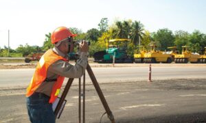
A licensed land surveyor isn’t just someone with a fancy tripod and GPS equipment. They’re certified professionals who understand land movement, boundary law, and precise elevation control. After a freeze, they can help you spot small issues before they turn into headaches.
Here’s what they often check right after the first hard frost:
- Curb and driveway elevations. Even slight changes in slope can cause water to pool near garages or foundations.
- Drainage paths. The first freeze can shift the way water drains off your lot, especially after heavy rain.
- Property corners and monuments. New construction or plowing can move or bury markers.
- ADA ramps and sidewalks. For properties that border public walkways, verifying slope compliance avoids city violations later.
By catching these early, your surveyor helps you fix drainage or boundary problems before winter snow covers them—or before spring melt makes them worse.
Road Improvements Can Shift More Than Pavement
Rochester and Monroe County have been busy upgrading infrastructure this year. That’s great for drivers, but not always for property owners. When a road near your home is resurfaced or regraded, the heavy machinery can accidentally disturb monuments—those metal pins or markers that define your boundary corners.
If you’ve noticed that your sidewalk or driveway apron was replaced during recent projects, your corner stakes might now be buried or misaligned. It’s not something you can see easily, but it matters. The next time you—or your neighbor—put up a fence, pour concrete, or add landscaping, those few inches could lead to an argument about where the true property line is.
A licensed land surveyor can perform a quick boundary re-tie to make sure your property line records match the real-world layout. That’s especially smart if your home sits along one of the roads involved in the East River Road or other county projects completed this fall.
Why 0.10 Feet Matters for Drainage
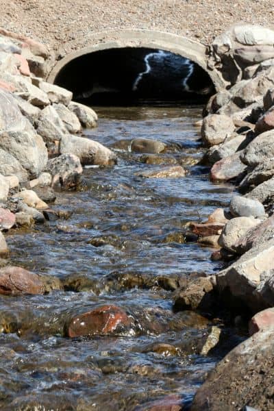
You might wonder, “Can a tiny slope change really matter?” Absolutely. Water always finds the lowest point. When the soil under new pavement or curbs expands and contracts during freezing weather, that small difference can send meltwater in the wrong direction.
In Rochester’s winter climate, that can mean ice forming in driveways, puddles freezing near garage doors, or basement leaks when the snow finally melts. A licensed land surveyor uses precise elevation tools to measure these subtle shifts and confirm your property still drains as designed.
This isn’t just about comfort—it’s about prevention. Fixing a drainage or grading issue early is far cheaper than repairing foundation cracks or replacing washed-out pavement in the spring.
How to Double-Check Your Property Using Public Tools
If you’re curious about what’s around your property, Monroe County actually offers a helpful online resource. Their GIS Map Gallery shows survey monuments, GPS base stations, and parcel data. You can look up your address, see nearby markers, and even measure approximate distances.
While it’s not a replacement for professional surveying, it’s a great way to visualize your area. A licensed land surveyor can use this same database to confirm which county benchmarks tie to your lot, giving you an accurate snapshot of your current conditions.
Real-Life Situations Rochester Homeowners Face
Every winter, surveyors across Monroe County see the same pattern: a few homeowners act early, and the rest call when problems show up.
- Drainage gone wrong: One homeowner noticed ice sheets forming on the driveway each morning. A quick survey revealed the new road crown was slightly higher, forcing water back toward the property. Adjusting the apron slope solved it before major damage.
- Fence confusion: After roadwork, a family found their backyard fence encroached on the city right-of-way. A boundary check with a licensed land surveyor saved them from a legal dispute with the city.
- Permit delays: A small business owner planning an addition had to redo an elevation certificate because the previous data no longer matched post-freeze elevations. Catching that early avoided costly redesigns.
When Should You Call a Surveyor?
Right now—before winter sets in completely. Once snow piles up, survey markers and ground features are harder to access. Ideally, you’d call within one to two weeks after the first freeze or after any nearby road improvement is completed.
During the visit, your surveyor will recheck elevations, confirm your property corners, and ensure your drainage still performs properly. If something looks off, you’ll get practical recommendations you can handle before spring.
The Bottom Line
Rochester’s unpredictable weather can do more than just ruin weekend plans—it can quietly reshape the land around your home. Combine that with all the recent roadwork, and it’s easy to see why a post-freeze checkup is worth it.
A licensed land surveyor offers peace of mind that your property boundaries, elevations, and drainage are still in line after the season’s first cold snap. The sooner you act, the easier it is to prevent bigger issues later.
If your street was recently improved or if you’ve noticed new puddles forming after the frost, schedule your survey now. One quick visit today could save you from thousands of dollars—and a lot of headaches—when spring thaw rolls around.
