Welcome to ALTA Survey New York

Your Final Stop for Your ALTA Survey Needs!                              Contact us today for a free quote!

This site is intended to provide you with information on ALTA Surveying in New York. If you’re looking for a New York Land Surveyor, you’ve come to the right place. If you’d rather talk to someone about your land surveying needs, please call our toll-free number at (888) 808-9783 today. For more information, please continue to read.

ALTA Survey New York

Land Surveyors are professionals who make precise measurements to determine the size and boundaries of a piece of real estate.  While this is a simplistic definition, boundary surveying is one of the most common types of surveying related to home and land owners. If you fall into the following categories, please click on the appropriate link for more information on that subject:

ALTA Survey New York services:

    1. I need to know where my property corners or property lines are. (Boundary Survey)
    2. I have a loan closing or re-finance coming up on my commercial property. (ALTA Survey)
    3. I need a map of my property with contour lines to show elevation differences for my architect or engineer. (Topo Survey – ALTA Survey plus Table A Item 5.)
    4. I’ve just been told I’m in a flood zone or I’ve been told I need an elevation certificate in order to obtain flood insurance or prove I don’t need it. (Flood Survey)
    5. I’m purchasing a lot/property for a commercial use. (ALTA Survey – Item 5 and/or Item 11b may also need to be discussed.)
    6. I’m purchasing a larger tract of land, acreage, that hasn’t been subdivided in the past. (Boundary Survey)
author avatar
Surveyor

More Posts

Electric buses parked at a new charging site where an alta land title survey ensures accurate construction planning.
alta survey
Surveyor

Why an ALTA Land Title Survey Comes First in EV Projects

Rochester is getting ready for a cleaner and smarter future. This month, New York State announced more than $80 million in new funding to add zero-emission buses and electric charging stations across the region. Some of that money will support transit sites here in Rochester, helping the city cut down

Read More »
Land surveyors reviewing plans on site with GPS equipment during OPUS delays affecting ALTA Title Survey work
alta survey
Surveyor

OPUS Delays Disrupt ALTA Title Survey Schedules

If you’ve been waiting on an ALTA Title Survey, you may have noticed that things are moving slower than usual. Reports are taking longer. Projects that should be finished by now are still on hold. The reason isn’t your surveyor—it’s the federal government. Since the government shutdown on October 1,

Read More »
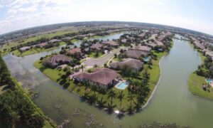
Aerial view of suburban homes next to water channels showing flood zone areas where a FEMA Elevation Certificate may be required for closing
flood damage
Surveyor

FEMA Elevation Certificate: Don’t Let Closings Stall

Buying a home is stressful enough without extra surprises. Now imagine you’re only a few days away from closing, your lender is ready, and your moving truck is on standby. Suddenly, you hear that the sale can’t go through because you don’t have a FEMA Elevation Certificate. This single piece

Read More »
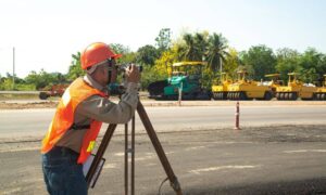
Construction surveyor using equipment to check ground levels at a road construction site
construction
Surveyor

Why Every Project Needs a Construction Surveyor

A construction surveyor may not be the first person you think of when starting a building project. Yet their role could mean the difference between a smooth development and a costly disaster. In the last week, a dramatic sinkhole in Bangkok swallowed cars, power poles, and part of a road

Read More »
Aerial view of a residential subdivision illustrating subdivision surveys with clearly divided lots, roads, and houses for land development planning.
boundary surveying
Surveyor

Subdivision Surveys: What Developers Must Know Before Building

If you’re a developer, you might have heard about subdivision surveys. But what exactly are they, and why are they so important before you start building? This blog will explain subdivision surveys in simple, clear terms. You’ll learn why these surveys are key to making sure your project goes smoothly

Read More »
Licensed surveyor operating a UAV survey drone on a construction site
land surveying
Surveyor

UAV Survey Challenges: DJI Restrictions Ahead

Drones changed the way surveyors work. A UAV survey lets crews map land, check elevations, and stake out subdivisions faster than ever. In Monroe County, most surveyors use DJI drones for sitework. These drones are trusted, affordable, and easy to use with mapping software. But now, big changes may be

Read More »