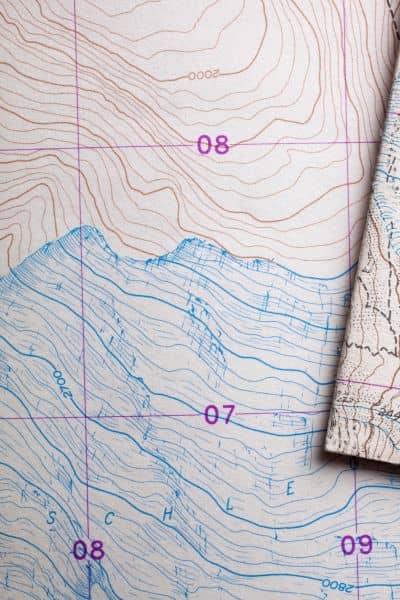
People everywhere are talking about maps thanks to GIS Day. Social media is full of students drawing roads, tracing buildings, and exploring satellite views of our world. It feels like mapping is everywhere right now. In Rochester, even local schools and groups joined the excitement this year. The conversations are fun and inspiring, and they make us look at land in a new way. However, while all these maps look impressive, only a topo survey shows the real shape and elevation of your land. A topo survey does something a digital map cannot do: it reveals what is actually happening on your property, right under your feet.
GIS maps are great at showing where places are. They show zoning, parcels, parks, and streets. They help us understand locations and neighborhoods. They also help you see things like flood zones and soil types. Because of this, GIS tools are very helpful. But they can make land look flat and simple, when in reality, most land is not flat at all. Rochester has hills, dips, slopes, and drainage paths that you cannot see on even the best GIS map. The land surface can change every few feet, especially in older neighborhoods and on lots near the river or creeks.
The Big Disconnect Between Online Maps and the Land Under Your Feet
This is the part many people miss. Online maps suggest that every yard is smooth and even. Yet a yard might tilt toward a neighbor’s home, slope down behind a shed, or form small pools after snow melts. These details may seem small at first. But over time, they can lead to big problems. Water can gather at the wrong corner. Soil can erode slowly. A fence can lean. A driveway can crack. A backyard project can flood. Therefore, even though mapping is popular and exciting right now, we still need a way to understand the true land surface. That is where a topo survey matters most.
A topo survey does not replace GIS tools. Instead, it completes them. GIS helps you explore your property from a distance. Meanwhile, a topo survey gives you a close, precise, physical understanding of the ground. It measures small changes in elevation and shows how the terrain rises and falls. Unlike a regular map, a topo survey shows the actual shape of your land. You can see the highest point and the lowest point. You can trace how water will flow. You can understand which direction the ground slopes on each side of your home. Because the data is collected on site, it reflects your real conditions, not a general overview.
How Weather Makes Ground Shape Even More Important
Homeowners often deal with tricky ground conditions throughout the year. We have snow that melts fast during warm days and then freezes again at night. Water can travel through yards in strange patterns. Some blocks drain well, but others send stormwater toward foundations or basements. Many older neighborhoods include uneven soil or leftover grading from past construction. It is no surprise that many homes here struggle with drainage. Sometimes homeowners do not notice the issue until they see pooling water or wet basement walls. Even then, they may not understand the root cause until a topo survey reveals the shape of the land.
In a city like Rochester, even a slight tilt can change everything. A backyard might slope in several directions. A low spot can form behind a garage. A fence line can lean downhill. A patio might need leveling. Because land surfaces can shift over time, many homeowners are unaware of how much their yard slopes. They only feel the results: flooding, ice patches, damp soil, erosion, or unwanted runoff. However, after a topo survey, these patterns become clear. Once the real shape of the land is visible, it becomes easier to make informed plans.
Why Home Projects Work Better With a Topo Survey First
This matters even more when you start a project. It does not matter if the project is small or large. If you are planning to build a patio, you need to know how the ground slopes. If you want to extend your driveway, you must understand where water currently flows. If you want to add a retaining wall, you need precise elevation data. Even a garden shed can impact drainage if the yard has a hidden slope. You might think a small project will be simple. But without the right information, it could create new problems, and it could cost more to fix later.
When contractors understand the land shape early, they can work smarter. They can design solutions that fit the site instead of fighting against the natural grade. Because of this, the topo survey becomes more than a map. It becomes a planning tool. It cuts down on surprises, confusion, and wasted effort. It also helps you avoid second attempts, which are often more expensive than doing things right the first time.
How GIS Tools and Topo Surveys Work Together

Now that GIS is trending, there is a strong opportunity for homeowners. The excitement of mapping can help you study your land with fresh curiosity. You can open the Rochester online GIS map, search your parcel, and explore your property online. You can see zoning rules and neighborhood data. You can compare your lot to others nearby. But that is only half of the story. The next step, and the most important one, is learning the true shape of your property.
GIS tools show the big picture, while a topo survey shows the ground as it really is. When you combine both, you understand your land from two angles: the wide view and the detailed one. Once you see that difference, it becomes easier to recognize how elevation mapping works on your property and why those small changes in height matter so much in real life.
Seeing Your Land From a New Angle
Once you have the topo survey, you can make confident decisions. You can talk to contractors with clarity. You can select better locations for structures. You can plan a yard that drains well. You can prevent damage before it happens. Instead of guessing, you rely on information.
GIS Day reminds us that mapping is powerful. It inspires people to explore the way land shapes our lives. But no matter how detailed an online map looks, your property has a story that it cannot tell. Your land has depth, contours, and hidden features that matter. The topo survey reveals them.
Your land is more than a point on a map. It is a living surface that deserves to be understood. Now is the perfect time to start.


