How LiDAR Mapping Is Used in Real Projects
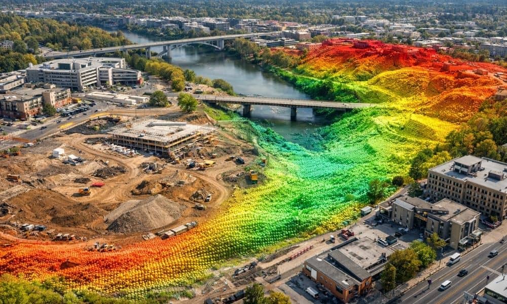
Rochester is seeing a shift in how roads, utilities, and new developments get planned. Instead of relying on older ground measurements, many projects now start with lidar mapping. This change is happening because cities need more accurate land data before construction begins. Old records do not always match the real ground anymore. Some areas have […]