
Rochester’s riverfront is changing. Old industrial buildings along the Genesee River are coming down. New homes, businesses, and public spaces are starting to take their place. While most people notice demolition and construction, very few see what happens first. Before any building begins, every successful project starts with a construction survey.
This step may not seem exciting. However, it plays a major role in how smoothly a project moves forward. In riverfront areas like Rochester, it often prevents delays, mistakes, and extra costs.
Riverfront Sites Come With Hidden Challenges
At first, a riverfront property may look like open land. In reality, these sites often have a complicated past. Many riverfront parcels once held factories, warehouses, or fuel storage.
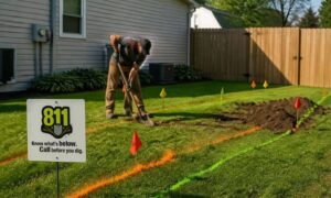
Because of this history, land conditions change over time. Property lines may not match old maps. Elevations may shift closer to the river. Utilities may sit where no one expects them.
Without accurate survey data, builders face serious risks. A construction survey helps remove these unknowns before work begins.
What a Construction Survey Really Does
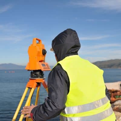
Many people think a construction survey only involves placing stakes in the ground. In truth, it does much more.
A construction survey sets exact horizontal and vertical control across the site. In simple terms, it shows where everything belongs and how high or low it should be. Engineers, architects, and contractors rely on this information every day.
Because of this, the survey connects design plans to real land. Without it, even strong designs can fail once construction starts.
Why Accuracy Matters Near the River
Riverfront construction leaves little room for error. Small mistakes can lead to big problems.
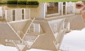
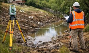
For example, elevation matters more near water. Just a few inches can affect drainage, flood risk, and building stability. At the same time, riverfront projects must meet strict city and environmental rules.
A construction survey confirms grades, slopes, and control points early. As a result, builders avoid rework and fail inspections later. When everyone uses the same survey control, teams stay aligned and mistakes drop.
Old Survey Data Can Cause New Problems
One common mistake in redevelopment is using outdated survey data. Many riverfront sites still rely on surveys done years ago. However, land rarely stays the same that long.
Over time, erosion, fill, and past construction change the site. Utilities move. Structures disappear. If a project uses old information, errors show up quickly.
A current construction survey reflects today’s conditions. It shows what exists now, not what existed in the past. This gives developers confidence before moving forward.
How Construction Surveys Save Time and Money
Delays cost money. Redesigns slow progress. Fortunately, construction surveys help prevent both.
When survey data is accurate, contractors build in the right place the first time. Foundations line up correctly. Utilities match the plans. Inspections move faster because measurements match approved drawings.
Without proper survey control, work may stop while errors are fixed. Permits may need changes. Small issues can grow into large setbacks.
Starting with a construction survey keeps projects on track from the beginning.
Supporting Permits and Inspections
Many riverfront projects involve city review, environmental rules, or public funding. Because of this, clear documentation matters.
A construction survey provides verified data for permits and inspections. City reviewers expect accurate elevations and site control. Inspectors use survey points to confirm compliance.
When survey records are clear, approvals move faster. When they are missing or unclear, delays follow. For developers, this can affect schedules, financing, and public trust.
When a Construction Survey Should Start
Timing matters as much as accuracy.
A construction survey should begin before final design decisions are locked in. This allows engineers to adjust plans based on real conditions. It also reduces surprises once construction starts.
In riverfront redevelopment, surveys often continue during construction. Surveyors check layout, confirm elevations, and document completed work. This keeps the project aligned from start to finish.
Why Local Experience Helps
Every city has its own survey systems and challenges. Rochester is no exception.
Local experience helps surveyors understand riverfront elevations, past industrial layouts, and city requirements. This knowledge improves accuracy and reduces delays.
For developers and property owners, working with a local surveyor lowers risk and improves communication with project teams.
Construction Surveys Set the Foundation for Success
Riverfront redevelopment comes with high stakes. Property value, safety, and long-term use all depend on getting details right.
A construction survey sets the foundation for every step that follows. It aligns plans with real land conditions. It protects budgets and schedules. Most importantly, it gives projects a clear starting point.
As Rochester continues to redevelop its riverfront, successful projects will share one thing in common. They all begin with a construction survey—before the first shovel ever hits the ground.