
If you work in construction or land development, you probably know how hard it is to survey tight lots and vertical builds. These projects come with special challenges that make traditional surveying slow, expensive, and sometimes dangerous. That’s why drone surveying has become a smart, modern solution. It offers a faster, safer, and more accurate way to collect the information you need. In Rochester, where space is limited and buildings grow taller, drones make surveying easier and better.
What Is Drone Surveying?
Drone surveying uses small flying machines called drones to take pictures and measurements of land or buildings. These drones have special cameras and sensors that capture detailed data from above. Instead of sending people with tripods and measuring tools to walk the site, a drone flies over the area and collects all the needed information in a few hours.
This method saves a lot of time and money. Plus, it keeps workers safe by removing the need to climb ladders or squeeze into tight spaces. For cities like Rochester, where construction sites can be crowded and tricky, drone surveying offers a big advantage.
Why Are Tight Lots a Problem?
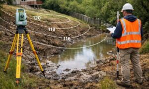
Rochester has many older neighborhoods and busy downtown areas where space is tight. A “tight lot” is a small piece of land squeezed between buildings, roads, or other obstacles. Surveying these lots the old-fashioned way is hard because crews have little room to work. They might not be able to set up their equipment properly or move around easily.
This can slow down projects and cause mistakes. For example, if surveyors can’t accurately measure the boundaries or slopes, builders might run into problems later, like hitting underground pipes or building in the wrong place.
That’s where drone surveying comes in. Drones fly right over these tight spots and capture clear images from every angle. They can see places people can’t reach safely. Drone teams use this data to create detailed maps and 3D models of the lots. This helps developers and builders plan more accurately and avoid costly delays.
What Makes Vertical Builds Different?
Vertical builds mean construction projects that go upward, like multi-story apartments or office buildings. Rochester has been growing vertically to fit more homes and businesses into limited spaces. But surveying tall buildings is tricky.
Traditional surveyors might have to climb scaffolds, use cranes, or work from ladders to measure the exterior of tall buildings. This process takes a lot of time, costs more money, and can be dangerous.
Drones change all that. They can easily fly around a tall building and take detailed measurements without putting anyone at risk. Equipped with advanced cameras and 3D scanners, drones capture every part of the building’s exterior, from the roof down to the lower floors.
This information lets architects and engineers create precise 3D models. They can check for damage, plan renovations, or make sure new construction matches the design. In Rochester, this means vertical projects move faster and safer.
How Does Drone Surveying Work?
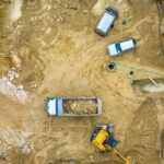
The process starts with planning a flight. The drone pilot decides the path the drone will take to cover the whole site. Then, the drone flies over the area, taking hundreds of photos and measurements.
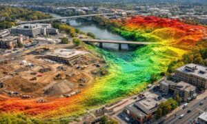
Next, special software puts all those images together into detailed maps and 3D models. These models show every corner of a tight lot or every side of a tall building with amazing accuracy.
Because drones fly high and can move into tight spots, they gather data that traditional surveyors can’t reach easily. This makes drone surveying perfect for Rochester’s tight urban lots and vertical builds.
How Do Companies Use Drone Surveying?
More and more construction companies use drone surveying as part of their regular workflow. After collecting the data, they upload it into design software like CAD or BIM. This allows architects, engineers, and builders to look at the site in 3D before starting work.
Thanks to drones, teams catch potential problems early. They spot issues before construction begins, saving time and money.
Also, drone operators follow FAA rules and local regulations to fly drones safely around buildings and people. They get training to avoid accidents and respect privacy.
All these factors help projects in Rochester start on time, run smoothly, and finish on schedule.
Why Is Drone Surveying Growing?
Drone technology keeps getting better. New drones have improved sensors that can capture even more detailed data. Artificial intelligence (AI) helps process this data faster and more accurately. Soon, drones might even monitor construction sites in real-time, alerting teams to problems as they happen.
For Rochester’s busy construction scene, this is exciting news. Developers will be able to manage projects better, avoid delays, and reduce costs. Drone surveying will become a key tool for building safely and efficiently.
The Benefits of Drone Surveying for Projects
In summary, drone surveying offers many benefits, especially for tight lots and vertical builds:
- Speed: Drones complete surveys much faster than traditional methods.
- Safety: Surveyors stay on the ground, avoiding dangerous climbs or cramped spaces.
- Accuracy: Drones capture detailed, high-resolution images and 3D data.
- Cost Savings: Faster surveys and fewer mistakes reduce overall project costs.
- Better Planning: Detailed models help teams plan construction with confidence.
For developers and builders, these benefits mean smoother projects, fewer surprises, and stronger results.
Considering Drone Surveying?
Drone surveying is quickly becoming a valuable tool. Whether you’re dealing with a compact site or a larger-scale build, drones can provide accurate and detailed data from above.
Many land development experts are now incorporating drone technology into their workflow to save time, reduce on-site risks, and deliver clearer insights that support better decision-making. It’s a practical way to manage site challenges and keep your projects on track.
If you’re curious, it might be worth exploring drone surveying on one of your upcoming projects to see how it fits your workflow.